13/03/2018-19/03/2018
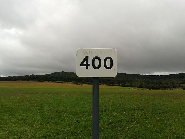
400 editions of Wochennotiz/weeklyOSM! Celebrate with us this milestone | Image © Pyrog / WikiMedia CC BY-SA 3.0
Mapping
- Russell Deffner starts a second RFC for the proposed
shop=cannabistag. - The voting phase on the proposal about aviation obstacle lights is currently open. This proposal involves the precise tagging of lights on tall obstacles (towers, buildings), that work as collision avoidance for aircraft in flight.
- Another proposal on the subject of contractors, for example for the construction of an office building, was published by Christopher Baze as a tag
contractor=. The voting is open until April. - Carlos Brys, from Argentina, reopens the discussion in the forum about the tags for various paving types, especially the “Brazilian” type (a variant of the Portuguese paving) which was previously mentioned on the Tagging mailing list.
- Geochicas launched their project on Twitter called #LasCallesDeLasMujeres (the streets of women), in which they generated a map to analyse the gender balance in street nomenclature in Latin America and Spain, linked to the Wikipedia biographies of women who have a street named after them.
- The proposal about pedestrian connections between ski lifts and pistes has been approved.
- Strava has updated its heatmap imagery.
Besides not displaying places with very little activity, the maximum zoom level is now limited to 12.
It will be harder to trace or align ways in most cases due to the heavily pixelated heatmap.
Community
- OpenStreetMap has reached one million registered map contributors!
- Geohipster interviewed someone behind the Twitter account Anonymaps.
- Levente Juhász tweets about his new open-access publication about OSM contribution patterns and how to foster long-time mappers.
- Maurizio Napolitano (user napo) published a proposal on the Wiki for “Mappers in Residence”. This suggests replicating in OSM the Wikipedian in Residence experience: a volunteering idea designed to help institutions or companies donate their information to the open knowledge world.
- “OpenStreetMap, MapaNica and the Buses in Nicaragua” is the title of a presentation recently held in Esteli, Nicaragua, that explains the mapping process of bus routes in Managua and Estelí. More info is available on the event’s blog post.
- OpenCageData interviewed with Andy Mabbett, who is active in both Wikidata and OpenStreetMap communities. He speaks about the connections between the two.
- Valentina Carraro and Bart Wissink wrote a paper about minorities’ under-representation on OpenStreetMap, and the risk of real-world inequalities seeping into potentially democratic crowdsourced projects. The full article is behind a paywall.
Imports
- In Portugal, massive data seems to have been imported for two months without prior agreement nor documentation.
- Ilya Zverev got ahold of NavAds dataset of over 59K fuel stations worldwide. Data are currently being reviewed and prepared for the import – the progress can be followed on the Import mailing list and on the dedicated wiki page.
OpenStreetMap Foundation
- Michael Reichert suggests on the OSMF-Talk mailing list that some inactive or less active sections from the OSM forum without moderators be closed to improve use of moderators’ time.
- On March 15th the OSMF board met. Nakaner has published a German report in the OSM-Forum. Christoph comments in his user blog on the discussion about the translation of the OSMF website.
Events
- Lars Lingner reminds
 (automatic translation) about the upcoming OSM Hackweekend, which will take place in the DB-Mindbox in Berlin on April 14th-15th.
 - The next Grazer Linuxtage will take place on 27-28 April in Graz / Austria at the premises of the FH Joanneum, Automotive Engineering course. Among many other contributions, a JOSM workshop can also be attended. Entrance is free.
- The 6th Annual Conference organised by OpenStreetMap France will take place from 1 to 3 June in Pessac on the campus of the University of Bordeaux-Montaigne. Presentations can now be submitted.
- On April 7th the general meeting of the Swiss OSM Association takes place at the Office for Geoinformation in Solothurn followed by a mapping party.
 (automatic
 Humanitarian OSM
- sev_osm reports in his diary (automatic translation) in detail on a workshop he did in Dakar with several members of the local OSM community, including teaching various advanced editing techniques, handling several available imageries, the OSM ecosystem and its governance.
- The minutes of the March 1st board meeting of HOT US Inc. have been published.
- Biondi Sima explains, what the Indonesian HOT team has planned to do next as part of the InAWARE project after completion of the Jakarta project.
 (automatic
 Maps
- James2432 works on rendering craft businesses in OSM Carto.
Open Data
- The Uruguayan gvSIG Community and GeoForAll Iberoamérica are organising the 5th Free and Open Source Geographic Information Technologies Conference, that will take place in Montevideo this October.
- The municipality of Tirana agreed to donate geospatial data to OpenStreetMap using an open license.
- The “Asia Foundation” shows in a photo blog how the Nepalese community celebrated Open Data Day. Kathmandu Living Labs organized a mapathon where many participants were introduced to the possibilities of OpenStreetMap.
Licences
- Wikimedia strongly opposes (automatic translation) a EU motion that is being modified last minute and would imply Wikimedia Commons would have to implement upload filters. John Weitzmann says that Wikipedia will not be spared (automatic translation).
Software
- A history analysis platform for OpenStreetMap is currently being developed at HeiGIT. It will make OSM data from the full history of edits more easily accessible. Check out the project‘s first ohsome Nepal Dashboard preview.
- An OSM map as wallpaper on your smartphone? This web service operated by Alvar Carto makes it possible.
- In a report (automatic translation) the Potsdamer Neueste Nachrichten describes the start-up Calimoto. Their navigation app for motorcyclists is characterised by its preference for curvy routes.
- In the OSM-Forum a new editor was introduced, which can primarily add new 3D buildings. It comes from the creators of PlaceMaker, a paid plug-in for SketchUp that imports 3D geodata into SketchUp and prepares it. The developers also uploaded a tutorial video.
Programming
- Starting May 1st, the public Geofabrik downloads will no longer contain metadata about OSM users. Accessing the complete extracts will require logging in with an OSM account.
Releases
- Simon Poole explains what the Vespucci version 10.2 will bring, in this blog post.
Did you know …
- … a script to show the results of a database query in a map?
- … the flosm OSM theme maps? There’s a new site to create your own individual map themes.
- … OpenMapTiles? Here you can create vector world maps with a set of tools, which you can use for hosting or offline use. The program is available as free software at OpenMapTiles.org.
- … this video that illustrates our mapping activity in OpenStreetMap since 2006?
OSM in the media
- An article by CityLab on the gender distribution among mappers is being discussed on the diversity mailing list and Reddit. While commenters extend a welcome to mappers of all genders and backgrounds, the statistics cited in the article are met with scepticism.
Other “geo” things
- Google Maps is following OSM and now also offers data for wheelchair users. For the time being, however, only in selected cities and with a lot less information than OSM has available.
- According to a World Bank estimate, half of the world’s urban population lives on unnamed streets. The “Plus-Codes” from Google are an alternative to the usual addresses (city, street, house number). But it is also an alternative to proprietary systems like “what3words”.
- Google wants to make it easier for game developers to create games similar to Pokémon Go using the Google Maps API.
- In an article on SciDev, the principles of humanitarian mapping are discussed.
Upcoming Events
| Where | What | When | Country |
|---|---|---|---|
| Bremen | Bremer Mappertreffen | 2018-03-26 |  |
| Graz | Stammtisch Graz | 2018-03-26 |  |
| Rome | Incontro mensile | 2018-03-26 |  |
| Essen | Mappertreffen | 2018-03-27 | |
| Dusseldorf | Stammtisch | 2018-03-28 | |
| Osaka | もくもくマッピング! #15 | 2018-03-28 |  |
| Paraná | Creando mapas colaborativos libres ParanaConf | 2018-03-29 |  |
| Urspring | Stammtisch Ulmer Alb | 2018-03-29 | |
| Rennes | conférence découverte d’OpenStreetMap | 2018-03-30 |  |
| Lima | Yo mapeo | 2018-03-31 |  |
| Montreal | Les Mercredis cartographie | 2018-04-04 |  |
| Stuttgart | Stuttgarter Stammtisch | 2018-04-04 | |
| Bochum | Mappertreffen | 2018-04-05 | |
| Dresden | Stammtisch Dresden | 2018-04-05 | |
| Solothurn | 2018 SOSM AGM and mapping party | 2018-04-07 |  |
| Rennes | Cartographie des rivières | 2018-04-08 | |
| Poznań | State of the Map Poland 2018 | 2018-04-13-2018-04-14 |  |
| Disneyland Paris Marne/Chessy Railway Station | FOSS4G-fr 2018 | 2018-05-15-2018-05-17 | |
| Bordeaux | State of the Map France 2018 | 2018-06-01-2018-06-03 | |
| Milan | State of the Map 2018 (international conference) | 2018-07-28-2018-07-30 | |
| Dar es Salaam | FOSS4G 2018 | 2018-08-29-2018-08-31 |  |
| Bengaluru | State of the Map Asia 2018 (effective date to confirm) | 2018-11-17-2018-11-18 |  |
Note: If you like to see your event here, please put it into the calendar. Only data which is there, will appear in weeklyOSM. Please check your event in our public calendar preview and correct it, where appropriate.
This weeklyOSM was produced by Anne Ghisla, Nakaner, Polyglot, Rogehm, SK53, SeleneYang, Spanholz, Spec80, Tordanik, YoViajo, derFred, jinalfoflia, sabas88, sev_osm.