03/07/2018-09/07/2018
MapRoulette 3 1
Mapping
- Jeremiah Rose asks, on the tagging mailing list. if it is feasible to provide links to accessible restaurant menus. He suggests two possibilities for the tag syntax: url:menu=* or url:accessible_menu=*.
- OpenStreetMap announced,via an official blog post, that Bing Streetside imagery is available in the online editor iD. Streetside is now the 3rd available street-level imagery in iD together with OpenStreetCam and Mapillary. The blog post says that Streetside will “probably become available” in other editors like JOSM. Please note before using this imagery that the licence from Bing has certain restrictions.
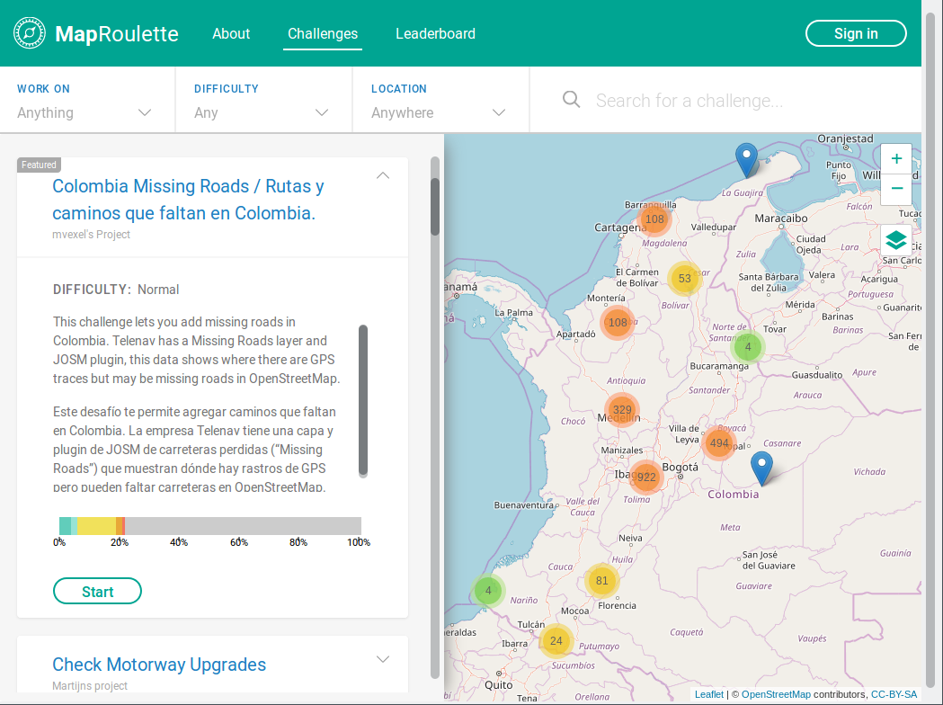
- Martijn van Exel has released the 3rd version of MapRoulette. MapRoulette will give you a random task in OSM to work on. Since 2013 about 1.5 million tasks to improve OSM have been completed. Martijn is blogging about the new features of in a series of posts. His first post is concerned with the introduction of location, category and text based filters.
- On the German OSM forum (in German), a user came across a trap street on another map. What should OSM show? Let the cat out the bag? An interesting discussion ensues.
- If you like sauna you might be interested in the new proposal. It is trying to bring order into the current muddle.
- A member of Amazon’s Logistics team has asked
 in the German forum how they can address missing turn restrictions to OSM mappers. They fear that OSM notes could be left disregarded.
 in the German forum how they can address missing turn restrictions to OSM mappers. They fear that OSM notes could be left disregarded.
Community
- On the talk mailing list, Frederik Ramm mentioned a scientific paper about imports into OSM and their effect on the local mappers’ communities. The answers mention the varied impact of imports around the world and in the history of OSM, and therefore exclude any universal recommendation for imports.
- Pablo Sanxiao does a good job explaining (automatic translation) that OpenStreetMap is not actually a map, but rather a database filled with geospatial data, continuously updated and improved by volunteer mappers and other actors, alike.
- [1] Martijn van Exel also introduced his new tool Meet Your Mapper. It shows you the mappers and their number of contributions in any area based on a relation ID as a table. It also allows you to export the statistics.
- Only 11% of the streets in Rosario (Argentina) are named after a woman.
 (automatic
 OpenStreetMap Foundation
- The OpenStreetMap web site and API will be
read-onlyfor around 30 minutes starting at 10:00 UTC on Sunday 15th July, whil the services are migrated to an alternate data centre. (Tweet) - The company Cesium, a US based company offering services around 3D maps and Geospatial data analysis, announced that it is now a corporate OSMF member.
Events
- FOSS4G Tokail will be held Aug 24th and 25th at Aichi University.
Humanitarian OSM
- HOT has held Community Knowledge Sharing Webinars between July 11th-16th to share experiences of 15 HOT communities about the topics gender, youth, advocacy, data integration and Leave No One Behind.
Maps
- The uMap 1.0.0 release candidate was announced on the mailing list. Major changes are the merger of Leaflet.storage and django-storage, the move to Django 2.x, which does not support Python 2.x anymore, an improved permission panel, easier customisation, filtering and unicode markers.
- A thread on searchandrescue subreddit brings to attention the combined pitfalls of OSM’s (but not only) incomplete data about hiking trails and renderer’s grouping choices. The discussion was started by the case of hikers who followed a challenging hiking trail on OSM, that was rendered exactly the same as an easy trail by the app they were using.
switch2OSM
- As our colleagues from the OSM-US twitter team have noticed that the company ESRI has created a vector map with OpenStreetMap data to match OSM’s default carto style that can be viewed online.
- Bing maps is now using building data from OSM in their proprietary maps. If you zoom in, you will see OSM based buildings and an OSM attribution. If available, Bing uses height information from OSM to render 2.5D building models.
Open Data
- Opendata.ch, the local Swiss chapter of the Open Knowledge Foundation, has hosted their annual conference. As the Swiss newspaper Netzwoche wrote , the topics included challenges, open data politics and an outlook as usual but also a lessons learnt about a project that struggles to sustainably finance itself due to on-off interests in the project.
- Mateusz Konieczny has written a new tutorial for learning how Overpass-Turbo is used. It is supposed to be useful also for people without any knowledge about OSM and without any programming skills.
Software
- Daniel from Mapbox, writes a diary post about how to run the full RoboSat pipeline on your own imagery using drone imagery from the OpenAerialMap project, taking the area of Tanzania as an example.
- Mateusz Konieczny describes how screenshots may be generated using a relatively simple Python script. Easy to update screenshots are likely to be useful in documentation like tutorials.
Programming
- Michael Spreng has started to implement a better integration of the Overpass API in Umap and is looking for help with the front-end.
- Peter Karich from the company GraphHopper, wrote a blog post about the visualisation of road network reachability with deck.gl. Although network reachability visualisation is nothing new, the blog post describes how you can create fancy visualisations of reachability yourself.
Did you know …
- … the app OSMfocus? The open source app shows you the tag/values pairs of objects around you and makes it much easier to identify objects that need an update when passing them by. The source code was recently made available on GitHub and you can install the Android app from Google Play
Other “geo” things
- Ian Webster created Ancient Earth globe, a 4D visualisation of the Earth in various moments of the distant past – going back to 700 millions years ago. Better not use this for mapping those coastlines.
- Starting from iOS also third-party navigation apps can use Apples car integration Carplay. Sygic announced such a first integration, which uses OSM as one of many sources. Mapbox also offers an integration via their Software Development Kit.
- You might not do so, but please do not write down names from door bell nameplates during mapping. Even your hand-written notes can be seen as a “file” as the European Court of Justice ruled against Jehova’s Witnesses. 😉
- The Australian website spatialsource wrote an article about the MapXplorer’s new web-based un|earth:: app. The app allows you to browse through Landsat images and the changes over the last 32 years. The app supports simple image manipulation capabilities but is limited to Australia.
Upcoming Events
| Where | What | When | Country |
|---|---|---|---|
| Brussels | OSMAnd route engine hacking | 2018-07-16 |  |
| Cologne Bonn Airport | Bonner Stammtisch | 2018-07-17 |  |
| Lüneburg | Lüneburger Mappertreffen | 2018-07-17 | |
| Moscow | Schemotechnika 17 | 2018-07-17 |  |
| Karlsruhe | Stammtisch | 2018-07-18 | |
| Mumble Creek | OpenStreetMap Foundation public board meeting | 2018-07-19 |  |
| Essen | Mappertreffen | 2018-07-21 | |
| Tokyo | 東京!街歩き!マッピングパーティ:第21回 増上寺 | 2018-07-21 |  |
| Greater Manchester | More Joy Diversion | 2018-07-21 |  |
| Nottingham | Pub Meetup | 2018-07-24 | |
| Dusseldorf | Stammtisch | 2018-07-25 | |
| Lübeck | Lübecker Mappertreffen | 2018-07-26 | |
| Milan | State of the Map 2018 (international conference) | 2018-07-28-2018-07-30 |  |
| Stuttgart | Stuttgarter Stammtisch | 2018-08-01 | |
| Bochum | Mappertreffen | 2018-08-02 | |
| Amagasaki | みんなのサマーセミナー:地図、描いてますか?描きましょう! | 2018-08-05 | |
| Dar es Salaam | FOSS4G & HOT Summit 2018 | 2018-08-29-2018-08-31 |  |
| Buenos Aires | State of the Map Latam 2018 | 2018-09-24-2018-09-25 |  |
| Detroit | State of the Map US 2018 | 2018-10-05-2018-10-07 |  |
| Bengaluru | State of the Map Asia 2018 | 2018-11-17-2018-11-18 |  |
| Melbourne | FOSS4G SotM Oceania 2018 | 2018-11-20-2018-11-23 |  |
Note: If you like to see your event here, please put it into the calendar. Only data which is there, will appear in weeklyOSM. Please check your event in our public calendar preview and correct it, where appropriate.
This weeklyOSM was produced by Anne Ghisla, Nakaner, Polyglot, Rogehm, SK53, Spanholz, Spec80, SunCobalt, derFred, jinalfoflia.
Hello,
It seems like OSMfocus app on Google Play isn’t updated since 2014.
Regards,
Adriano Cunha