06.11. – 12.11.2018
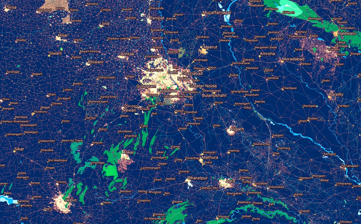
10 let OSM v Indii 1 | Obrázek Arun Ganesh (@planemad) (CC-BY-SA 3.0)
OSM CZ
- Marián dokončil opravu tagování STK.
- Opraveno nefunkční napojení na české taginfo.
- Je to OpenStreetMap nebo není ve Flexibusu Brno – Praha?
- Mapathon Missing Maps v Olomouci, více informací zřejmě jen na Facebooku.
- Jak mohl vzniknout takovýto divný GPX záznam trasy? Vlákno stojí za přečtení pro GPS fajnšmekry a technologické nadšence 🙂
OSM SK
- Nová stránka “Kdo jsme” v rámci úvodu pro začátečníky na wiki freemap.sk.
- Bílá díra na Slovensku v mapě energetiky.
- Upravený skript na nahrávání GPX logů od hopinSK.
- Které cyklotrasy vykreslovat? Jen ty s
refnebo s určitou minimální délkou nebo i pidi kousky? - Podivné chování MapTileru pro slovenský jazyk a data z Wikipedie.
- Informace o mapathonu Missing Maps v Bratislavě 27.11.2018 (ale pouze na ksichtoknize!)
- Nefunkční TEST Locus motiv – nevykresluje některé čtverce.
- Informace o chybném označení neoficiálních městských čtvrtí v Martině.
Mapování
- Gregory Marler vytvořil návod na Youtube, ve kterém popisuje, jak používá své vlastní 360 stupňové obrázky z Mapillary pro editace v JOSM.
- Vypadá to, že mapování provedené firmou Grab (takový Uber jihovýchodní Asie) způsobuje velké problémy. Citujeme Russe McD "… to co vidíme, je další velká organizace, která způsobuje, že banda placených amatérů řádí na hřišti pojmenovaném OSM a neplacení dobrovolníci po nich uklízí jejich binec." Celé vlákno zde.
- Nedávno jsme informovali o tom, že Telenav otevřel zdrojový kód své detekce uličních cedulí postavený na strojovém učení a odpovídající tréningové sady dat pro rozpoznávání téměř 100 typů těchto cedulí. Telenav používá svoji platformu OpenStreetCam, službu podobnou Mapillary. Plugin pro JOSM OpenStreetCam vizualizuje v poslední verzi právě tyto detekce. Martijn van Exel popisuje práci pokročilého validátora, aneb jak velmi rychle validovat celou trasu s mnoha detekovanými cedulemi přímo na webu OpenStreetCam.
- Na fóru se diskutovalo o tom, zda mají být Aruba, Curaçao a Bonaire označeny jako nezávislé země nebo jako součást Nizozemského království. Vlákno dává určitý vhled na různé úrovně nezávislosti a oblasti patřící stále více nebo méně ke království.
Komunita
- Během posledních dvou týdnů pracovala (automatický překlad) francouzská komunita na úplnosti pokrytí policejních a strážnických stanic (celostátní a regionální policie) ve Francii. Projekt byl spuštěn po získání přístupu ke kvalitním otevřeným datům polohy a otvíracích hodin těchto stanic. Pro budoucí aktualizace (adresa, telefon, otvírací doba) je také k dispozici jedinečný identifikátor pro každou stanici. Projekt také vyčistí uzly s
amenity=policeale bez jména a dalších informací. Zahrnoval také práci na dokumentaci na wiki a spolupráci s National Gendarmerie Digital Mission. - [1] Arun Ganesh tweetuje upoutávku na nadcházející SotM Asia 17. – 18. listopadu 2018 v indickém Bangalore. Využil sérii pěkných vizualizací 10 let OSM v Indii.
- Stahovací služba u Geofabrik má mnoho uživatelů a Frederik Ramm, který ji provozuje, vždy hledá způsob minimalizace zátěže nabízením datových extraktů tak velkých jak je potřeba, ale zároveň tak malých, jak je to jen možné. Jeden z největších extraktů, pro který neexistuje rozdělení, je americký stát Kalifornie. Otázka na možnost rozdělení do několika extraktů odhalila, že největší roli hraje citlivost místních obyvatel.
- Uživatel Nop oznámil
 (automatický překlad) aktualizaci svých statistik o využití editorů na OSM Wiki.
 - Pět let po tajfunu Haiyan na Filipínách se uživatel seav vrací k tehdejší pomoci OSM. Přečtěte si, jak tajfun změnil OSM a místní komunitu na Filipínách.
- Kolumbijská nadace OpenStreetMap implementovala OSM nástroje ve španělštině (speciálně pro Latinskou Ameriku a Kolumbii). Jedná se mimo jiné o Tasking Manager a Umap. Spolu s dalšími nástroji je vše hostováno v datovém centru v Německu. Tato kampaň na financování žádá o podporu pro provoz infrastruktury na nejméně 2 roky.
- Světová banka přináší článek o OSM a jeho vzestupu lokálních mapperských komunit. Příspěvek zdůrazňuje tento typ mapování v Asii a Africe. Pro čtenáře WeeklyOSM to, vzhledem k množství informací o těchto projektech, nebude nic nového, stejně jako informace, že na tomto OSM projektu spolupracují vývojáři ze Silicon Valley, plánovači afrických měst a humanitární pracovníci.
- tyr_asd využil svůj OSM deník k poděkování OSM komunitě v Grazu, firmě Geofabrik a skupině Disastermappers Heidelberg.
 (automatický
 Importy
- Jeff Underwood z firmy Facebook zaslal rozsáhlou dokumentaci nazvanou Jak vlastně pracuje systém Facebooku pro import silnic s podporou umělé inteligence? o jejich systému pro generování dat pro OSM postaveném na strojovém učení. Facebook aktuálně nahrává data pro Thajsko a navazuje spolupráci s HOT v Indonézii.
Nadace OpenStreetMap
Události
- HOT oznámil, že HOT Summit 2019 se bude konat 19. – 20. září 2019 v německém Heidelbergu.
- FOSS4G 2018 Okayama (Okayama) se konal 4. a 5. listopadu, FOSS4G 2018 Tokyo pak 9. a 10. listopadu. Zde jsou sesbírány tweety k oběma akcím.
- Meetup skupina Montana GIS and Geospatial pořádala 14. listopadu v americké Heleně mapathon během GIS Day. Účastníci se seznámili s OSM nástroji a přispěli do úkolu HOT #5355 – Missing Maps: Myanmar.
 (
(Humanitární OSM
- MapAction, organizace pro humanitární mapování, publikovala report o pomoci, kterou její tři dobrovolníci a dva zaměstnanci poskytli po záplavách v Malawi v lednu 2015.
- 28. listopadu se bude konat (automatický překlad) od 18:00 do 21:00 Missing Maps Mapathon ve francouzském Grenoble.
Vzdělávání
- Volksfreund from Trier informují (automatický překlad) o spuštění projektu Erasmus+ podporovaném EU, ve kterém se mohou učitelé pěti zemí potkat v německém Saarburgu na rozsáhlém OSM školení. Článek speciálně zdůrazňuje odkaz na deník uživatele Severin Menard, který informuje o svých zkušenostech z Afriky. Celý projekt bude trvat dva roky jeho cílem je inspirovat mnoho studentů zúčastněných evropských zemí k “humanitárnímu mapování”.
Otevřená data
- Britská Geospatial Commission oznámí 26. listopadu tendr v hodnotě 1,5 milionu liber na data sbíraná uživateli. Částka je přibližně stejná jako náklady na celé OSM za jeho 14 let existence.
- Heidelberg Institute for Geoinformation Technology (HeiGIT) publikoval na GitHubu novou službu openelevationservice, Flask aplikaci pro získání nadmořské výšky z různých datových zdrojů pro geometrie typu bod nebo 2D a která je schopna vracet 3D geometrie v různých formátech.
- SmugMug, noví vlastníci Flickru, oznámili zásadní změny podmínek bezplatných účtů. Nově bude povoleno pouze 1000 fotek na jeden takovýto účet, což může mít vliv na některé OSM přispěvatele a bloggery, kteří používali Flickr pro ukládání fotek a jiných obrázků.
Software
- OSMCha dostal významné aktualizace. Nyní je OSMCha v souladu s nařízením GDPR a obsahuje nový způsob, jak obdržet nové vlastnosti z OSM. Wille publikoval dva příspěvky o tomto novém vydání.
- Tessio Novack a jeho kolegové z Heidelberg University publikovali volně přístupný článek o generování uživatelsky upravené sítě chodníků pro navigaci postavené nad daty OpenStreetMap a Openrouteservice. Prezentují a vyhodnocují jak jsou z OSM nejprve extrahovány faktory jako svěžest, družnost, tichost a jejich následné použití pro adaptaci tras.
Programování
- Iniciativa "GDAL Coordinate System Barn Raising" vybrala 144 000 USD pro vylepšení knihoven souřadných systémů použitých v open source nástrojích GDAL, PROJ, libgeotiff, PostGIS, a Spatialite. Nové knihovny poskytnou větší přesnost transformací mezi souřadnými systémy mimo jiné tím, že se vyhnou převodu přes WGS84 a eliminují odpovídající kroky navíc.
- Andy Allan, dlouhodobý přispěvatel OSM, bloguje o moderování, autorizaci a úkolech na pozadí pro OpenStreetMap. Poskytuje souhrn vývoje základního software pro OSM včetně pomoci od týmu Ruby for Good, jehož členové během svého pravidelného setkání doplnili spoustu vylepšení.
- Na svém blogu Christoph Hormann vysvětluje (automatický překlad) jak nakládat s rozbitou podporou Mapniku SVG vzorů oblastí, tedy reprezentaci oblastí jako jsou lesy nebo louky. Christoph připravil skript, který umožňuje jednoduše změnit formát, PNG nebo SVG, podle způsobu použití dat – SVG pro tisk a PNG pro online mapy.
Nová interaktivní dokumentace Openrouteservice API postavená na vue.js dostala nový modul pro LeafletJS mapy. Vyviňte a otestujte své projekty opravdu jednoduše:
- sestavte váš požadavek v grafice
- zavolejte službu
- vizualizujte na mapě
- stáhněte
- Christoph Hormann sdílí svou německou prezentaci o projektech otevřených map OSM komunity, které použil pro svou přednášku pro německou Společnost pro kartografii a geoinformatiku.
Nová vydání
- Německý web mobilesicher.de informuje (automatický překlad), že OSM navigační aplikace Magic Earth odstranila vazby na Google, Facebook a Twitter a nesdílí tak již žádná uživatelská data.
Věděli jste …
- … o informaci od Anonymaps o tweetu od Mapboxu, že Porsche používá navigaci založenou na OSM od Mapboxu i přesto, že již má základní modul od HERE. Rádi bychom upozornili, že procenta vlastnictví zmiňovaná u Anonymaps jsou špatná.
- … o moderovaném seznamu software pro OpenStreetMap?
- … o nástroji Osmoscope od Jochena Topfa pro opravování chyb v OSM? Zkusili jste a Osmoscope vám nevrátí do JOSM žádná data? To je pravděpodobně proto, že váš prohlížeč nemá certifikát pro JOSM nebo jste v JOSM nepovolili vzdálené ovládání. Zkuste si lokálně pustit JOSM a poté zadat do prohlížeče URL https://127.0.0.1:8112/version. Může se vám zobrazit chyba certifikátu, pak je potřeba potvrdit výjimku a dále by již vše mělo fungovat.
OSM v médiích
- Brazilský online magazín informuje o snaze Geochicas o využití ‘Las calles de las mujeres’ pro upozornění na ulice pojmenované po významných ženách.
Ostatní geo záležitosti
- Na blogu GIScience skupiny z univerzity v Heidelbergu upozorňují na projekt Wheelmap a využití dobrovolnicky sbíraných geografických informací pro zlepšení dostupnosti.
- Mapillary vydala vývojový kit pro open source software.
- V Německu je v provozu první cyklo stezka (automatický překlad) tvořená solárními panely. Start-up firma Solmare vytvořila první 90m dlouhou trasu s moduly na nízké napětí a nainstalovala je v německém Erftstadtu. Firma vidí tento směr jako velmi slibnou technologii pro budoucnost. Tagování této cyklostezky bylo navrženo za pomocí
surface=solar_panel. Existují i další podobné solární cyklostezky, například v Nizozemí (automatický překlad) (zatím bez správného otagování…).
Plánované události
| kde | co | kdy | země |
|---|---|---|---|
| Mumble Creek | veřejné zasedání rady Nadace OpenStreetMap | 15.11.2018 |  |
| Mannheim | Mannheimer Mapathons | 15.11.2018 |  |
| Freiberg | Stammtisch | 15.11.2018 | |
| Pamplona | Mapatón Pamplona – Médicos sin Fronteras | 16.11.2018 |  |
| Barcelona | Mapes i Birres (Trobada trimestral usuaris d’OSM) | 16.11.2018 | |
| Como | ItWikiCon 2018 | 16.11. – 18.11.2018 |  |
| Como | Mapping Party during ItWikiCon 2018 | 17.11.2018 | |
| Brno | State of the Map CZ 2018 | 17.11.2018 |  |
| Bengaluru | State of the Map Asia 2018 | 17.11. – 18.11.2018 |  |
| Vantaa | OSM GeoWeek 24h HOT Mapathon | 17.11. – 18.11.2018 |  |
| Wakayama | オープンデータソン in 雑賀崎 | 18.11.2018 |  |
| letiště Kolín – Bonn | Bonner Stammtisch | 20.11.2018 | |
| Lüneburg | Lüneburger Mappertreffen | 20.11.2018 | |
| Derby | Pub Meetup | 20.11.2018 |  |
| Reading | Reading Missing Maps Mapathon | 20.11.2018 | |
| Melbourne | FOSS4G SotM Oceania 2018 | 20.11. – 23.11.2018 |  |
| Toulouse | Rencontre mensuelle | 21.11.2018 |  |
| Karlsruhe | Stammtisch | 21.11.2018 | |
| Lübeck | Lübecker Mappertreffen | 22.11.2018 | |
| Alajuela | ES:State of the Map Costa Rica | 23.11. – 25.11.2018 |  |
| Manila | 【MapaTime!】 | 24.11.2018 |  |
| Dublin | Monthly Mapping Party | 24.11.2018 |  |
| Ivrea | Incontro mensile | 24.11.2018 | |
| Graz | Stammtisch Graz | 26.11.2018 |  |
| Brémy | Bremer Mappertreffen | 26.11.2018 | |
| Arlon | Espace public numérique d’Arlon – Formation Contribuer à OpenStreetMap | 27.11.2018 |  |
| Reutti | Stammtisch Ulmer Alb | 27.11.2018 | |
| Düsseldorf | Stammtisch | 28.11.2018 | |
| San José | Civic Hack Night & Map Night[1] | 28.11.2018 |  |
| Toronto | Mappy Hour | 03.12.2018 |  |
| Praha – Brno – Ostrava | Kvartální pivo | 05.12.2018 | |
| Stuttgart | Stuttgarter Stammtisch | 05.12.2018 | |
| Toulouse | Rencontre mensuelle | 05.12.2018 | |
| Bochum | Mappertreffen | 06.12.2018 | |
| Drážďany | Stammtisch Dresden | 06.12.2018 | |
| online via IRC | Pravidelné výroční setkání Nadace OSM | 15.12.2018 | |
| Heidelberg | State of the Map 2019 (mezinárodní konference) | 21.09. – 23.09.2019 | |
Poznámka: Pokud zde chcete vidět vaši akci
Toto číslo přeložil tom.k a redakčně upravil mkyral. Budeme velmi rádi, pokud podpoříte a oceníte naši práci tím, že budete dílo dále šířit, např. sdílením na sociálních sítích (like, retweet, plus…). Předem za to děkujeme.
Každé číslo v CZ verzi je promováno zde: @osmcz |
  @osmcz |
  OpenStreetMap |
  Talk-cz | osm_sk |
  rss
rss
Můžete nás kontaktovat e-mailem:  weekly@openstreetmap.cz
My blog post on pattern processing is also available in English – no need for Google translation:
http://blog.imagico.de/managing-patterns/