24/10/2017-30/10/2017
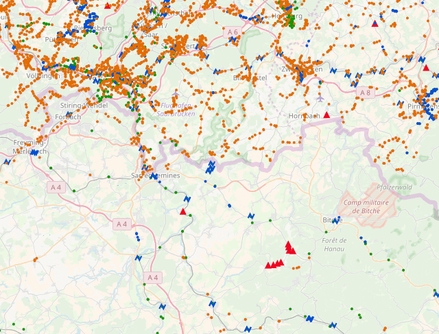
Public transport stops near the border between Saarland (north) and Lorraine (South), screenshot of OpenStreetMap Inspector, View “Public Transport – Stops” 1 | CC-BY-SA 3.0
Mapping
- [1] Geofabrik announced a revision of the public transport views in OpenStreetMap Inspector on their blog. Now, they show validator issues for Public Transport v2 route relations.
- Simon Poole suggests
 (automatic translation) the removal of
 note=*tags from carsharing provider “Mobility”‘s stations – these tags currently ask mappers not to modify these objects. - Frederik Ramm of the Data Working Group has deleted numerous POIs or removed their description tag in the last few days, on the suspicion of spammy edits performed by Search Engine Optimization (SEO) “sock-puppets”. There are several changeset discussions [1] [2] [3] [4] regarding Frederik’s changes. The “algorithm” for finding these POIs underwent some changes during the process.
- There’s a discussion in the German forum (translation) about mapping streets as areas. There are a couple of suggestions, including area:highway. This sort of mapping is popular in Poland (see for example around here).
- The contributor ionr asks the German forum about how to deal with
review_requested=yes. Besides the discussion, there are tips on tools to find such tags: Find Suspicious OpenStreetMap Changesets, OSMCha and osm-qa-feeds.
 (automatic
 Community
- Topi Tjukanov (@tjukanov) tweets an animation showing the “optimal routes by car from the geographic centre of the contiguous United States to +3000 counties”. The author posted a blog on how he creates these visualisations.
- Contributor acette wrote a post about the creation of OSM Visual History, an improved version of OSM Deep History. It features a more interactive user interface, with a map that shows older versions of OSM elements. Have a look for yourself and feel free to provide feedback to the author.
- The note in our previous issue that weeklyOSM will discontinue the calendar server on end of this year prompted a discussion on the Talk mailing list as to whether one of the users involved in the dispute should be banned from the OSM wiki.
- User Natenom reports (translation) about his first major change, which he made to OpenStreetMap with the help of the community, which included a new roundabout with corresponding relocation of the public transport relations and much more.
Imports
- On the Imports mailing list, a Swiss mapper shared details of a semi-automatic import planned at canton Basel-Stadt in Switzerland. A similar import had been initiated in 2015/2016 without the review of the Imports mailing list. However, the new proposal, currently in the planning stage, seeks review on the Imports mailing list.
OpenStreetMap Foundation
- OpenStreetMap UK asks if they should purchase a 360-degree camera for OpenStreetMap events and for renting it to OSM UK members.
- This year’s Annual General Meeting of the OSM Foundation will take place on December 9th. Voting will be limited to the fully paid members and members who have registered 30 days prior to the AGM date. If you are interested in voting, you need to register as a member or renew your subscription now!
- The minutes of the OSMF Board of Directors meeting on October 26th are now online. The topics were: guidelines for the use of the “State of the Map” trademark, a mailing list of the Advisory Board, planning the 2017 Annual General Meeting, a status report on current application procedures for new regional representations, and employment of administrative support for SotM activities.
- Members of FOSSGIS e.V., the de-facto local OSM chapter in Germany, discussed a proposal (automatic translation) by Frederik Ramm which asks to support a new routing server which could provide OSRM-powered routing on openstreetmap.de and openstreetmap.org.
- The State of the Map Working Group blogs about the experience of the 15 scholars from around the globe who attended State of the Map 2017. For all of them, the conference has been an inspiring experience, and a window to the international OSM community.
Events
- OSM Geography Awareness Week will take place around the world from November 12th to the 18th. Check the map for an event near you! HOT welcomes your help to break a mapathon record.
Humanitarian OSM
- Dale Kunce announces the new HOT code of conduct on the HOT mailing list.
- John Whelan complains on the HOT mailing list about the excessive amount of automatic emails sent by version 3 of the Tasking Manager following a Task evaluation.
- Safwat Halaby complains on the Talk mailing list about a HOT project in the West Bank, which has a number of problems. In the discussion following, voices are raised about a lack of quality awareness among the creators of HOT mapping projects and mapathon organisers.
Maps
- Support Klimaschutzkarte (climate protection map) with OpenStreetMap: The Climate Protection Map Germany of the Department of Geoinformatics at Heidelberg University helps to inform about local sustainable consumption, renewable energy, climate-friendly mobility and other aspects of climate protection in your region. Help to increase the awareness of this by entering corresponding locations to OSM.
- Christoph Hormann proposes a set of rendering solutions that improve map readability at high zoom levels in his blog. It is unthinkable to keep the same rendering of a certain type of way at all zoom levels. Paper cartography solved it by using different styles for each map; digital cartography has the extra challenge to keep rendering both consistent and clear at any scale.
Open Data
- Nathaniel Vaughn Kelso announces the immediate availability of the Natural Earth dataset, version 4.
Software
- Daniel Patterson from Mapbox announces an update to the OSRM demo server and explains the benefits of the changes.
- Christoph Eckert wrote a review of OsmAnd and MAPS.ME after using them on a small vacation.
Programming
- Thomas Gratier points out “An analysis of the Mapbox GL JS library by Delft University of Technology students (master-level)”.
- Mapbox announces GL expressions with the release of Mapbox GL JS v0.41.0.
- Roland Olbricht explains in detail in his blog post why he considers the Linux init system systemd unsuitable for the operation of the Overpass API. Systemd has recently repeatedly caused corrupt databases and serious errors with Overpass. Roland also presents alternative approaches.
Releases
- JOSM 13053 is the latest stable release. Usability on high-DPI display has been improved, among other things.
- For other software releases, please refer to OSM Software Watchlist from Wambacher.
Other “geo” things
- Shareloc, the free map API for creating and sharing OpenLayers maps, now offers the TopPlus-Web-Open map service of the BKG as a layer in the official demo. TopPlus-Web-Open is based on multiple free data sources, including OSM.
- Phil McLaughlin from Esri Ireland presented his thoughts about the Open Data Camp 2017 in Queens University, Belfast from a geographer’s point of view.
- A detailed test of the Casio WSD F20 Pro Trek-Smartwatch was published on Pocketnavigation.de . Among others the accuracy of the GPS receiver and navigation with different apps based on OSM and Google Maps map data was tested.
- The “Geoawesomeness” blog published an introduction to the Discrete Global Grid System (DGGS) standard announced by the Open Geospatial Consortium (OGC).
- As of next year, Ghana will no longer use a Google-based system for address locating and thus save $400,000 in annual license fees. Instead, a self-developed system from the Ghanaian postal service will be used.
- An article on Atlas Obscura presents the challenges climate change poses to cartography.
- Everton-supporting pranksters have turned local rivals Liverpool blue by “defining” a new search term for Anfield.
- A press release reported on the collaboration between Telenav and Waylens, which has developed a special wide-angle Horizon car camera, whose GPS data and recordings are automatically transferred to the Telenav Cloud to improve OSM data for autonomous driving.
Upcoming Events
| Where | What | When | Country |
|---|---|---|---|
| Budapest | OSM Meetup Budapest | 2017-11-06 |  |
| Helsinki | GIS Expo OSM Workshop | 2017-11-07 |  |
| Rostock | Rostocker Treffen | 2017-11-07 |  |
| Havana | CubaConf, La Conferencia Cubana de Tecnologías Libres | 2017-11-07-2017-11-09 |  |
| Munich | Stammtisch | 2017-11-08 | |
| Indiana | Purdue University Libraries GIS Day Mapathon <small>(sign up)</small>, West Lafayette | 2017-11-08 |  |
| Berlin | 113. Berlin-Brandenburg Stammtisch | 2017-11-09 | |
| online via Mumble | FOSSGIS e.V. Vorstandssitzung | 2017-11-09 | |
| Tokyo | 東京!街歩き!マッピングパーティ:第13回 大宮八幡宮 | 2017-11-11 |  |
| Rennes | Réunion mensuelle | 2017-11-13 |  |
| Lyon | Rencontre mensuelle | 2017-11-14 | |
| Nantes | Réunion mensuelle | 2017-11-14 | |
| Heidelberg | Disastermappers Missing Maps mapathon to support OSM GeoWeek | 2017-11-14 | |
| Karlsruhe | Stammtisch | 2017-11-15 | |
| Ulm | Mapping Munyu (OSM Geo Week) | 2017-11-15 | |
| Rennes | Cartopartie humanitaire de Bamako (OSM Geo Week) | 2017-11-15 | |
| Digne-les-Bains | Cartopartie : Libre information sur les services de santé, tous acteurs, tous concernés ! | 2017-11-16 | |
| Helsinki | HOT-OSM Finland Geoweek Mapathon 2017 | 2017-11-18 | |
| Taipei | OpenStreetMap Taipei Meetup, MozSpace | 2017-11-20 |  |
| Bonn | 100! Bonner Stammtisch | 2017-11-21 | |
| Lüneburg | Mappertreffen | 2017-11-21 | |
| Nottingham | Pub Meetup | 2017-11-21 |  |
| Scotland | Pub meeting, Edinburgh | 2017-11-21 | |
| Lima | State of the Map LatAm 2017 | 2017-11-29-2017-12-02 |  |
| Yaoundé | State of the Map Cameroun 2017, lors des premières Journées nationales de la Géomatique | 2017-12-01-2017-12-03 |  |
| Dar es Salaam | State of the Map Tanzania 2017 | 2017-12-08-2017-12-10 |  |
| Bonn | FOSSGIS 2018 | 2018-03-21-2018-03-24 | |
| Poznań | State of the Map Poland 2018 | 2018-04-13-2018-04-14 |  |
| Milan | State of the Map 2018 (international conference) | 2018-07-28-2018-07-30 |  |
This weeklyOSM was produced by Anne Ghisla, Nakaner, Polyglot, SomeoneElse, Spanholz, Spec80, YoViajo, derFred, jinalfoflia.