19.12. – 25.12.2017
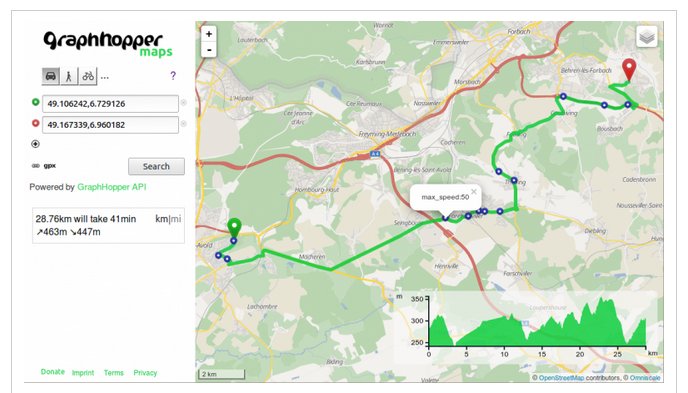
Zobrazení různých maximálních rychlostí podél trasy 1 | © přispěvatelé OpenStreetMap © Graphhopper
OSM CZ
- Jak Google používá strojové vidění pro generování mapových podkladů a dále odvozuje nová data na základě už existujících. (viz i níže)
- Nově se objevivší Pokémon Go mapper v Novém Jičíně.
- Nový kruháč v Brně a první verze jeho zmapování.
OSM SK
- Zajímavý toposkop s jedním neznámým cílem a využitím dat OpenStreetMap.
- Strava je znovu přidána mezi vrstvy na freemap.sk. A k tomu zázrak na počkání.
- Nová značená žlutá cyklotrasa pod Sološnicou.
Mapování
- DevSeed oznámili svůj Datový tým pro humanitární krize. Jedná se o profesionály v oboru prostorového data managementu a strojového učení. Pro lepší podporu misí jejich partnerů se spojili s Mapboxem pro rozšíření své mapovací kapacity. S okamžitou účinností bude peruánský data tým Mapboxu fungovat jako součást Development Seed a vytvoří základ DevSeed Data týmu.
- Hlasování pro tagování magnetických levitujících monorailů běží již od 6. října.
Komunita
- Björn by rád věděl, jestli může vytvořit PDF přímo z OpenStreetMap URL.
- Uživatel Zverik informuje na svém blogu, že Maps.Me umožňuje navigaci s využitím relací
subwayalight_rail. - TheSilphRoad je stránka, která zkoumá hru Pokémon Go. Publikovali článek, který pomáhá zkušeným hráčům Pokémon Go pochopit, co je OSM a jak do něj užitečně přispívat.
- Wille píše ve svém deníku o novém mail listu pro projekt OSMCha. Tento mail list bude v základu určen pro obecné dotazy, oznámení ohledně OSMCha, spolupráci na plánech a nových vlastnostech a k informování uživatelů o chystaných změnách.
Importy
- Někdy pomůže dostat věci z vašeho systému – někdo mapující v Kalistoze přidal detailní stížnost na problémy spojené s mapováním v oblasti, kde dominují špatné importy. Na fóru jsou různé odpovědi a vysvětlení toho co se stalo s tím, že naštěstí i v těchto oblastech jsou to většinou relikty z minulosti.
Události
- Oliver Rudzick propaguje OSGeo Code Sprint 2018 na akci BaseCamp v Bonnu a doporučuje včasnou rezervaci, protože možnost ubytování je omezená. Sprint se bude konat paralelně s konferencí FOSSGIS. Jak Michael Reichert zdůrazňuje, OSM sobota bude 24. března.
- FOSS4G se bude konat v roce 2018 v tanzanském Dar es Salaam.
- Na 13. – 14. dubna 2018 polská komunita organizuje konferenci State of the Map v Poznani.
Mapy
- Bernd Weigelt objevil jinou cestu, jak na zařízeních Garmin instalovat mapy se stínováním kopců pro oblast Německa, Rakouska a Švýcarska.
- Oleksiy Muzalyev prezentuje svoji novou vícejazyčnou webovou aplikaci Travel Info Pack. Umožňuje uživateli zvolit kategorii POI, která bude na mapě zvýrazněna a u každého POI nabízí možnost vyhledat Wikimedia obrázky v okolí.
Software
- OsmAnd je dostupný pro operační systém Apple iOS ve verzi 2.0. Nejzajímavější nová vlastnost je navigační funkce. Aplikace může být stažená přes iTunes Store.
Programování
- Poslední verze routovacího API GraphHopper nabízí nové možnosti: detaily cesty a možnost něco v cestě vynechat. Ostatní API projektu GraphHopper byla také aktualizována.
- Jason Remillard by rád, s využitím OSM dat jako trénovací množiny, natrénoval algoritmus strojového učení pro rozpoznávání basebalových hřišť. Jeho kód je k dispozici na GitHubu.
Nová vydání
- OSM editor pro mobilní zařízení Vespucci má nové hlavní vydání a z verze v0.9.9 poskočil na verzi 10:
- Interní validátor byl přepracován
- Přidány presety pro režim C
- Přidána podpora pro vlastní úkoly
- Nová verze Mapbox Maps SDK pro Android v5.3.0 přináší nové jméno, vylepšený výkon pro CJK a mnoho dalšího.
- Mapbox Navigation SDK pro Android v0.8.0 přichází s nasloucháním událostí při použití předpřipraveného UI, fixní zvukové SSML tagy pro hlasové instrukce a uživatelskými notifikacemi.
Ostatní geo záležitosti
- WeltN24 informuje
 (automatický překlad) o nedávném slavnostním otevření lanovky na německý vrchol Zugspitze, která překonává tři světové rekordy. Lanovka je samozřejmě již zmapována v OpenStreetMap.
 - Kdo bude v budoucnu vytvářet mapy? Člověk, stroj nebo oba společně? Článek od Mapillary hledá odpovědi.
- Justin O’Beirne publikoval detailní srovnání stavu Google Map a map Apple, včetně intenzivního využití strojového učení u Google. O’Beirne se domnívá, že bohatství informací v Google Maps je ohromující. @vtcraghead se na Twitteru podělil o své postřehy, jak by s tím mohla naložit komunita OpenStreetMap.
- Interaktivní mapa na koeln.de ukazuje oblasti bez ohňostrojů a bez bariér pro letošní silvestr v německém Kolíně.
- členové OSGEO (Open Source Geospatial Foundation) za posledních 5 let vyvinuli OpenDroneMap.org, open source projekt pro zpracování leteckých snímků z dronů. Není tu žádné přímé propojení s OpenStreetMap. Více detailů o tom, jak to celé funguje najdete zde.
- Ian Dees píše na blogu Mapzenu o projektu, který sbírá adresy umístění poboček z webu daného provozovatele. Data jsou pak konvertována do vhodnějšího formátu (GeoJSON) a vystavena na alltheplaces.xyz pod licencí Creative Commons’ CC-0.
 (automatický
 Plánované události
| kde | co | kdy | země |
|---|---|---|---|
| Denver | Online High School Mitchell, PoliMappers’ Adventures: One mapping quest each day | 01.12.2017-31.12.2017 |  |
| Montreal | Les Mercredis cartographie | 03.01.2018 |  |
| Albuquerque | MAPABQ (join us!) | 03.01.2018 |  |
| Stuttgart | Stuttgarter Stammtisch | 03.01.2018 |  |
| Pasov | Niederbayerntreffen | 08.01.2018 | |
| Lyon | Rencontre libre mensuelle | 09.01.2018 |  |
| Nantes | Réunion mensuelle | 09.01.2018 | |
| Berlín | 115. Berlin-Brandenburg Stammtisch | 11.01.2018 | |
| Tokyo | 東京!街歩き!マッピングパーティ:第15回 品川神社 | 13.01.2018 |  |
| Kyoto | 幕末京都マッピングパーティ#01:京の町家と大獄と | 13.01.2018 | |
| Brisbane | Brisbane Photo Mapping | 13.01.2018 |  |
| Řím | FOSS4G-IT 2018 | 19.02. – 22.02.2018 |  |
| Cologne Bonn Airport | FOSSGIS 2018 | 21.03. – 24.03.2018 | |
| Poznaň | State of the Map Poland 2018 | 13.04. – 14.04.2018 |  |
| Bordeaux | State of the Map France 2018 | 01.06. – 03.06.2018 | |
| Milán | State of the Map 2018, (mezinárodní konference) | 28.07. – 30.07.2018 | |
Poznámka: Pokud zde chcete vidět vaši akci
Toto číslo přeložil tom.k a redakčně upravil mkyral. Budeme velmi rádi, pokud podpoříte a oceníte naši práci tím, že budete dílo dále šířit, např. sdílením na sociálních sítích (like, retweet, plus…). Předem za to děkujeme.
Každé číslo v CZ verzi je promováno zde: OpenStreetMap CZ |
  @osmcz |
  Openstreetmap |
  Talk-cz | osm_sk |
  rss
rss
Můžete nás kontaktovat e-mailem:  weekly@openstreetmap.cz
Originál tohoto souhrnu připravili: Nakaner, Polyglot, SK53, Spanholz, Tordanik, derFred, jinalfoflia, sev_osm.