2022/12/06-2022/12/12
OpenStreetBrowser: 新カテゴリ: Pedestrian footways [1] | © OpenStreetBrowser.org | 地図データ © OpenStreetMap貢献者
速報
- OSMFの企業メンバーである4つの大企業は、Linux Foundationと協力して、新しいオープンなマッププラットフォームであるOverture Mapsを発表しました。マップのデータは、他のオープンソースからのデータを使用していますが、一部はOSMに基づいています。この開発と反応の詳細については、来週お知らせします。
マッピング
- Jake Coppingerは、360度のカメラとOpenDroneMapを使用して、航空画像のように使える点群データを作成する方法をデモンストレーションしました。
- Kai Johnsonさんは、米国の国立水路データセットを用いて、水路をマッピングする方法と制限事項について、詳しく説明しています。
- ユーザのLySioSは、フランスの住所のオープンデータのさまざまな情報源を説明
 ►しています。またコミューンレベル(BAL)で地域の住所データを使用してOSMのデータを生成する詳細な方法を伝えています。
 - Christoph Hormann(imagico)は、OpenStreetMapで南極大陸のマッピングに興味がある人のために、南極大陸の追加の画像レイヤを発表しました。
- ユーザのPhispiさんは、スレッドラン(山道をそりで滑り降りるスポーツ)のコースにタグ付けする
type=sledに対する提案をおこなって、コメントを募集しています。 - 道路の駐車スペースをマッピングするために提案された新しいスキーマに関する投票は終了しました。
賛成51票、反対2票、棄権1票で可決されました。
 ►
►
OpenStreetMap Foundation
- 12月10日(土)にOpenStreetMap財団の2022年年次総会が開催されました。会議の主な議題は、取締役および一部の作業部会からのさまざまな報告と、新しい取締役の選出でした。
四人の新しい理事が選出されました。アルファベット順で;
- Craig Allan
- Sarah Hoffmann
- Mateusz Konieczny
- Arnalie Vicario
理事会の報告には、
- 今期までの議長のGuillaume Rischard氏からの議長報告
- Roland Olbrichts氏からの財務報告 では、 2021年の決算報告 (こちらから)と、2022年の年次累計の暫定財務状況で構成されています。
- 新たに名称変更された財務ワーキング・グループ(以前の資金調達ワーキング・グループ)および人事委員会からの報告。
- OSMF事務局アシスタントであるDorotheaさんからは、今年の取締役会選挙で投票する資格のあるOSMFメンバーの内訳が報告されました。全体の数は2021年と変わりませんが、アジア太平洋地域では会員数がいくらか減少しており、中東地域では非常に少ない会員数が、さらに大幅に減少しています。
イベント
- BenHurさんは、SotMアジア2022と併催されたPistaNgMapaをレポートしました。
教育
- Anne-Karoline Distelさんは、クラノグ(湖上住居)のマッピング方法を説明する動画の第5回を公開しました。今回はWikiCommons画像の利用について説明されています。
- Narayan Thapaさんは、バネパ市(ネパール)で進められている屋上農園をドローンを使って調査しました。機械学習を利用して撮影画像を分析し、結果はOSMに入力されました。
OSM research
- Susanne Schröder-Bergen氏らは、地域のクラフトマッパーと、大企業や人道支援マッピング活動の間で発生する衝突や協力を分析した論文を発表しました。
- Patricia Solisさんは、YouthMappersの活動をまとめた書籍「SDGsのためのオープンマッピング」を出版しました。PDFでダウンロードできます。
地図
- Stamenさんは水彩風地図など様々な地図タイルを提供しています。#30daymapchallengeでもこれらの地図が数多く使われており、Stamenさんは利用事例をまとめました。ただ、タイルの維持管理にコストがかかっているため、今年で停止するとのことです。維持管理するためのアイディアを募集したところ、クラウドファンディングを提案する意見も挙がりました。
- watmildonさんは、住所データが入っていない建物が多い地域を表示する地図を作成しました。マッピングに取り組むエリアの選定に活用するそうです。
switch2OSM
- バンコク市(タイ)で、副市長の主導のもとで歩行者・自転車向けの交通データが集められたことをMishariさんが報告しています。
ライセンス
- Michael Kreilさんは、バイエルン州(ドイツ)の建物データベースを使って風力発電タービンが接地可能な場所を計算し、データを公開しました。するとバイエルン州は、データベース権を侵害しているとしてKreilさんを訴訟 しました。
ソフトウェア
- 持続可能な都市とコミュニティに関する国連/EU主催のハッカソンの結果が、YouTubeのビデオとして公開されています。
プログラミング
- Sarah Hoffman(lonvia)さんは、Nominatimのフロントエンドを、PHPからPythonで書き直して、大幅な機能強化を導入する計画を発表しました。この大きな変更のおかげで、ウェブサーバなしで、Nominatimを実行できるようになります。このプロジェクトは、NGI0 Entrustのサポートを受けています。
- ジョン・ダーリンプル氏により、OSMコミュニティサイトにおいて、機械学習を使用して米国政府のオープンソースソース(NAIP)から道路表面を分類する画像プロジェクトを報告しています。表面のタグを持つOSMのウエイをランダムに選択し、比較したところ80%以上の一致しています。反対する人もいますが、このアプローチは、「フライオーバー州」の地方道路に関する情報を大幅に改善する可能性を示しています。「フライオーバー州」とは、TIGERのインポート後に改善が進んでいない地域のことです。
- OSM運用チームは、タイルサーバtile.OpenStreetMap.orgへのアクセスに、パブリックURLを使用することを再周知しています(以前に報告しました)。変換する必要がある古いURLは、githubのリストで確認できます。
リリース
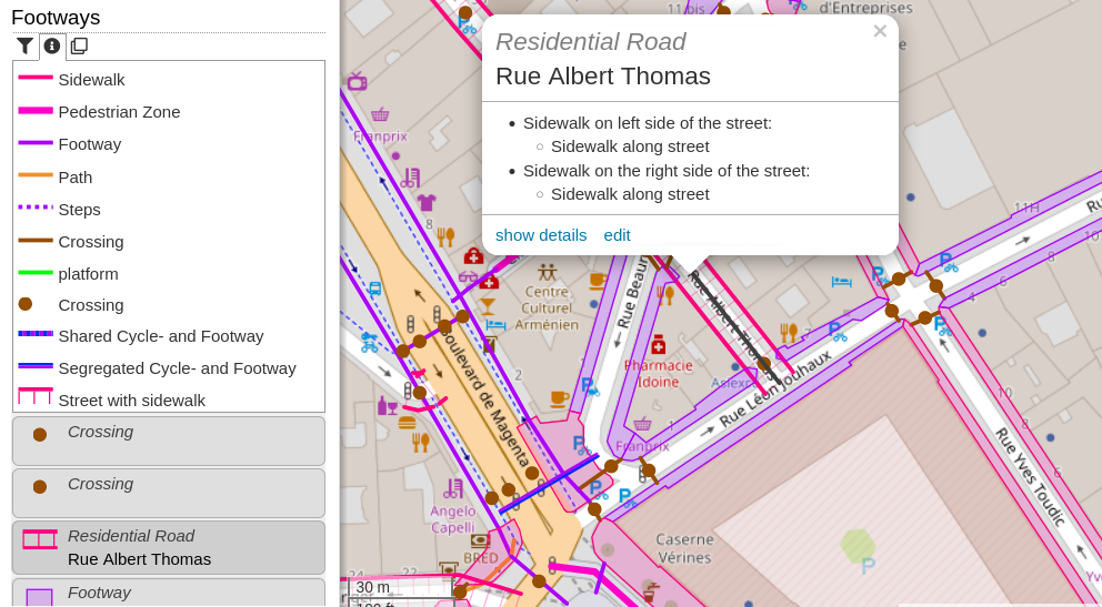
- [1] ユーザのshunk は、遊歩道、歩道(wayやroadとしてマップされる), 階段および歩行者エリアが表示される、 新しいOpenStreetBrowserのfootwayの分類を発表しました。オーバーレイは、OSMコミュニティサイトで議論 されています。
- OSMAndは、天候プラグインや新しい標準レンダリングエンジンなど、多くの新機能とアップデートを備えたリリース4.3を発表しました。
ご存知でしたか?
- ユーザのmceplは、日記のエントリーで、OSMの要素の重心を見つけるPythonプログラムを紹介しています。
メディア掲載
- 学生メディア「メガバイト」は、AIに関する記事の中で、HOTOSMプロジェクトを支援するRapiD編集について書いています。
その他の “ジオ” な事柄
- エコノミスト誌 は、ヨーロッパにおける通りの名前について議論しています(有料記事)。この記事では、ヨーロッパの4つの都市の通りの名前の学術的分析をとりあげています。残念ながら、OSMの
name:etymologyのデータではなくウィキペディアとウィキデータのデータを使用しました。
まもなく開催
| 場所 | 名称 | Online | 開催日 | 国 |
|---|---|---|---|---|
| London | London xmas pub meet-up | 2022-12-19 |  | |
| OSMF Engineering Working Group meeting | 2022-12-19 | |||
| Bruxelles – Brussel | OpenStreetMap meetup in Brussels | 2022-12-20 |  | |
| Lyon | Rencontre mensuelle Lyon | 2022-12-20 |  | |
| 158. Treffen des OSM-Stammtisches Bonn | 2022-12-20 | |||
| Lüneburg | Lüneburger Mappertreffen (online) | 2022-12-20 |  | |
| Karlsruhe | Stammtisch Karlsruhe | 2022-12-21 | | |
| Düsseldorf | Düsseldorfer OpenStreetMap-Treffen | ✓ | 2022-12-30 | |
| Stuttgart | Stuttgarter Stammtisch | 2023-01-03 | | |
| London | Missing Maps London Mapathon | 2023-01-03 | |
‘
Note: ここであなたのイベントを見たい場合は、カレンダーにそれを OSM Kalender 入れてください。そこにあるデータのみが、週刊 OSM に表示されます。 カレンダー 内で都市や国に言及するのを忘れないでください。
This weeklyOSM was produced by MatthiasMatthias, SK53, Strubbl, TheSwavu, derFred, miurahr, muramototomoya.